Any attempt to trace on a modern map the boundaries of the forest is bound to be hampered by changes which have taken place through new roads being constructed, old names being changed or lost, and boundary marks of trees, ditches and boulders either being destroyed or removed. Even the courses of the rivers have altered or changed, as for example where the perambulation speaks of following the old course of the Trent and the old course of the Leen. Some years ago in the course of road widening on the Derby road at the end of Annesley park, a large stone was removed from the roadside, which was undoubtedly the Blew Bolder mentioned in the perambulation of 31 Elizabeth, and also shewn on the John Manners map of Sherwood Forest circa 1593, but anyone who cares to turn down by the Shoulder of Mutton Hill along the Nuncargate road, can still see the mark stone in Nuncar Hedge, mentioned in the perambulation of 1662—the last one made.
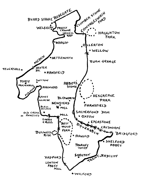 |
| Sherwood Forest and its bounds. |